Maps Showing Free and Slave States and Territories in 1837 and 1854
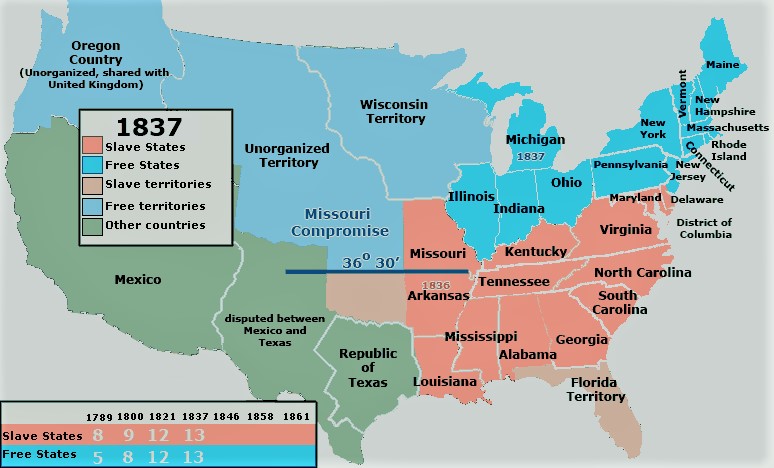
Map 1: 1837 (with the Missouri Compromise of 1820 prohibiting slavery north of 36 degrees/30 seconds in effect)

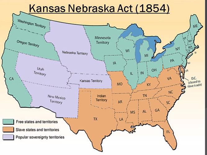
Map 2: 1854 (Free and Slave States and Territories after passage of the Kansas-Nebraska Act in 1854.)

